In 2025 the HMS Colossus dive trail was refurbished and extended. The “Start the Dive Trail” page has been changed to include updated descriptions for each dive station, along with a PDF which can be downloaded for printing.
We have added two new articles and a page of resources to the Colossus website.
Any Old Iron examines a previously unidentified iron object from the wreck, identifying it as the broken shank of a late 18th-century Admiralty stream anchor, likely damaged during a collision with HMS Culloden at the Battle of Cape St Vincent in 1797.
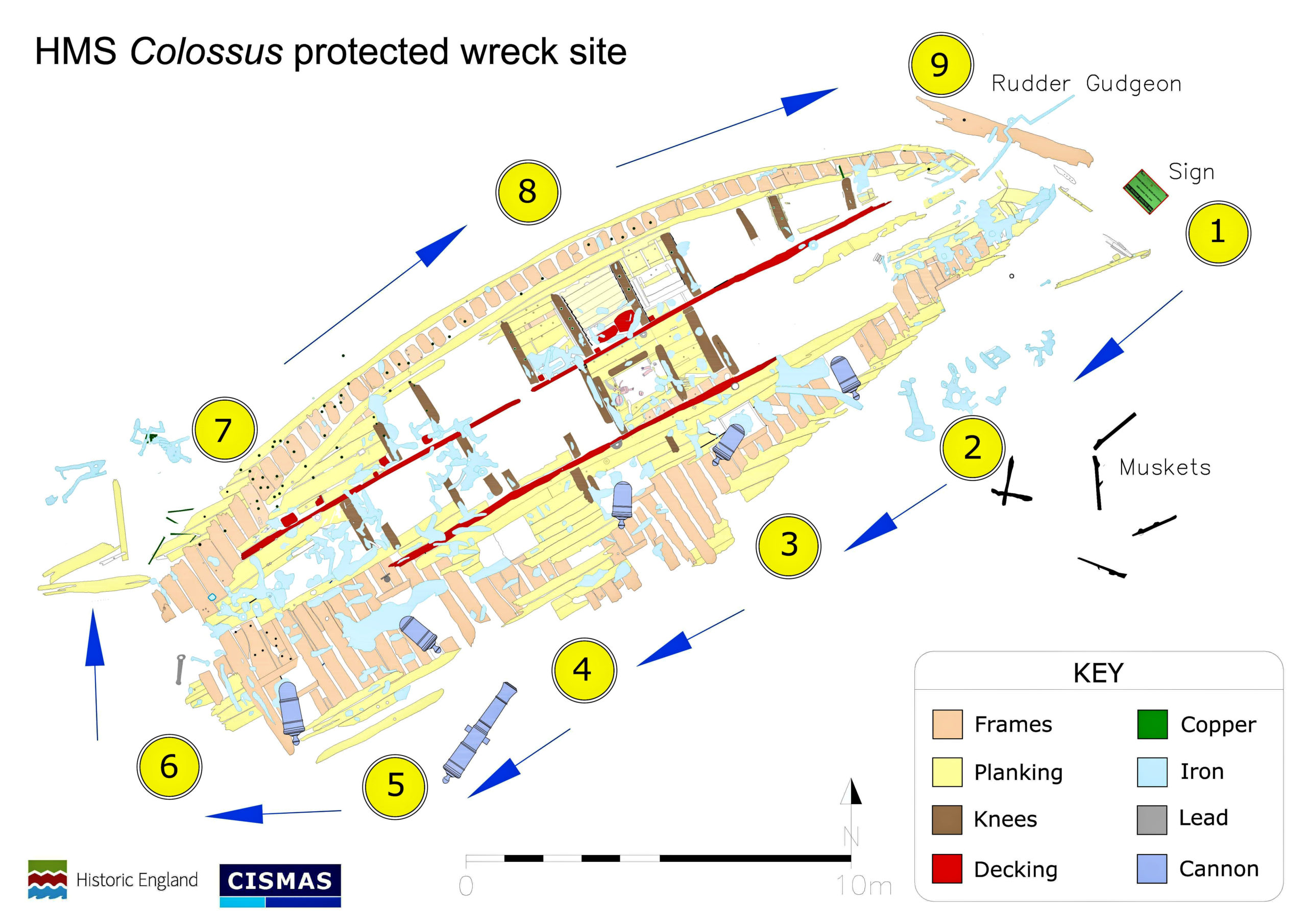
The Empty Gun Port explores how parts of Colossus have undergone significant changes since first recorded in 2001, with much of the inner hull planking and deck timbers now decayed or missing, exposing underlying structural elements and damage likely caused by gun recoil.
The Post-wrecking History page lists events on Colossus since the first intervention in 1799 to break up the wreck, through to geophysical surveys in 2024.
In the autumn of 2019 CISMAS undertook a refurbishment of the Colossus Historic Shipwreck dive trail.
Condition of the dive trail
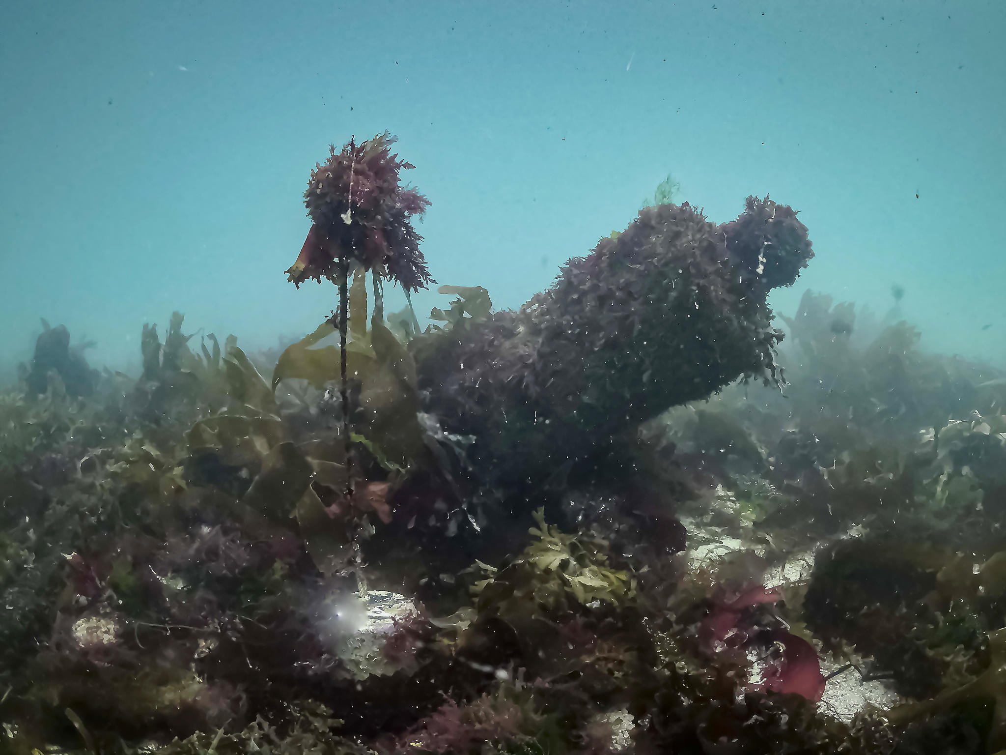
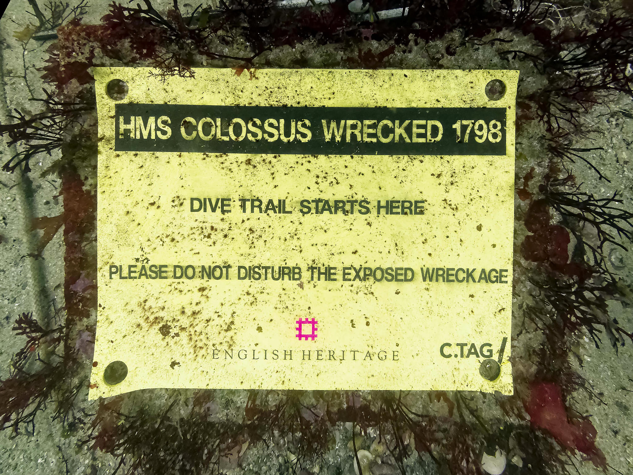
The dive trail was heavily covered in marine growth. The exposed wreckage was largely obscured by a bank of detached kelp over a metre deep. All the dive trail markers were heavily weeded, making the station marker numbers illegible. The dive trail sign was obscured by fine seaweed.
The seabed sign before cleaning showing how weed growth was obscuring the signOne of the station markers showing how the numbers of the markers had become obscured by weed.Station marker number six, next to one of the upstanding18lb iron guns (gun 6). Note the build-up of kelp around the gun.
Refurbishment
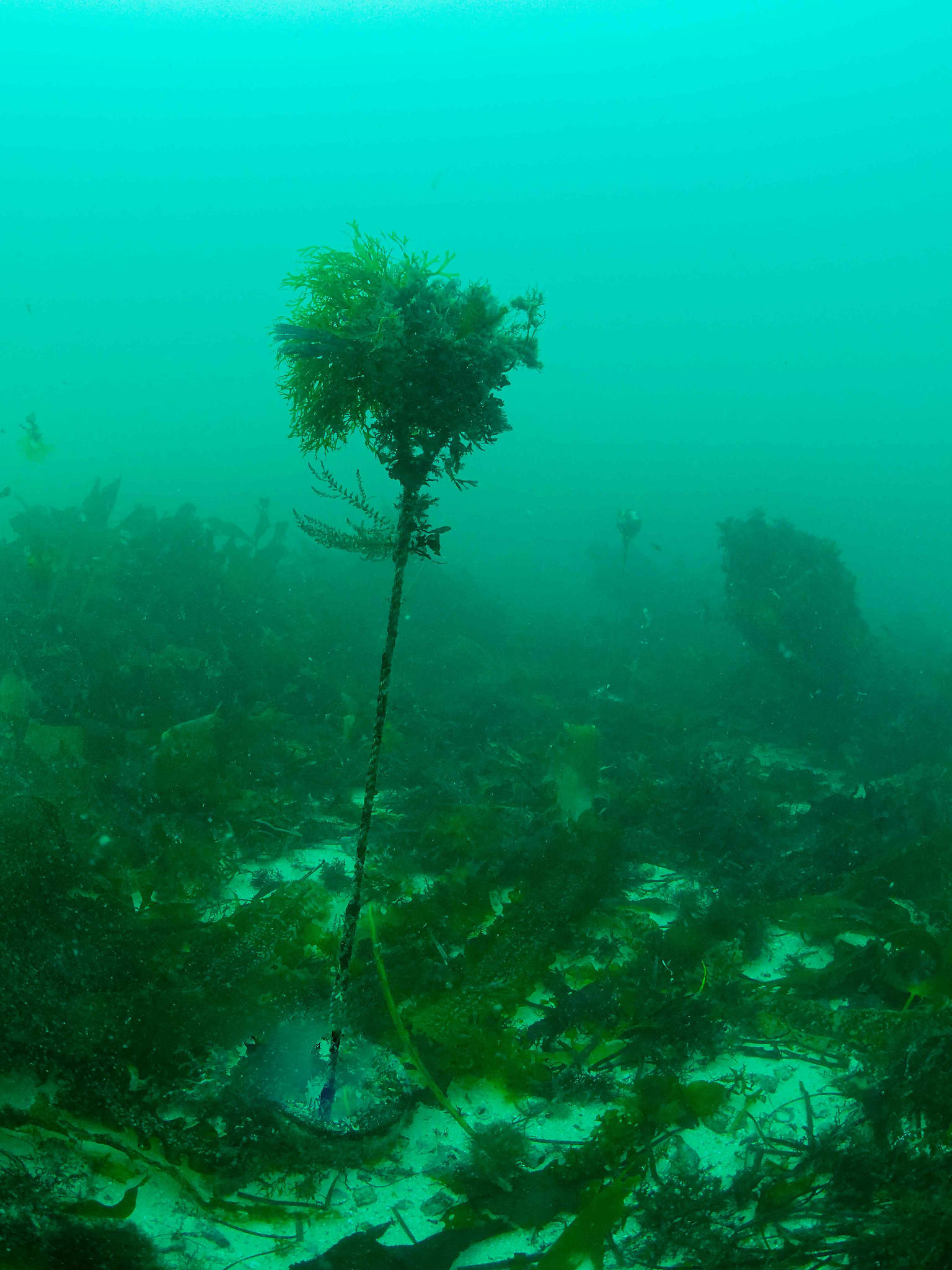
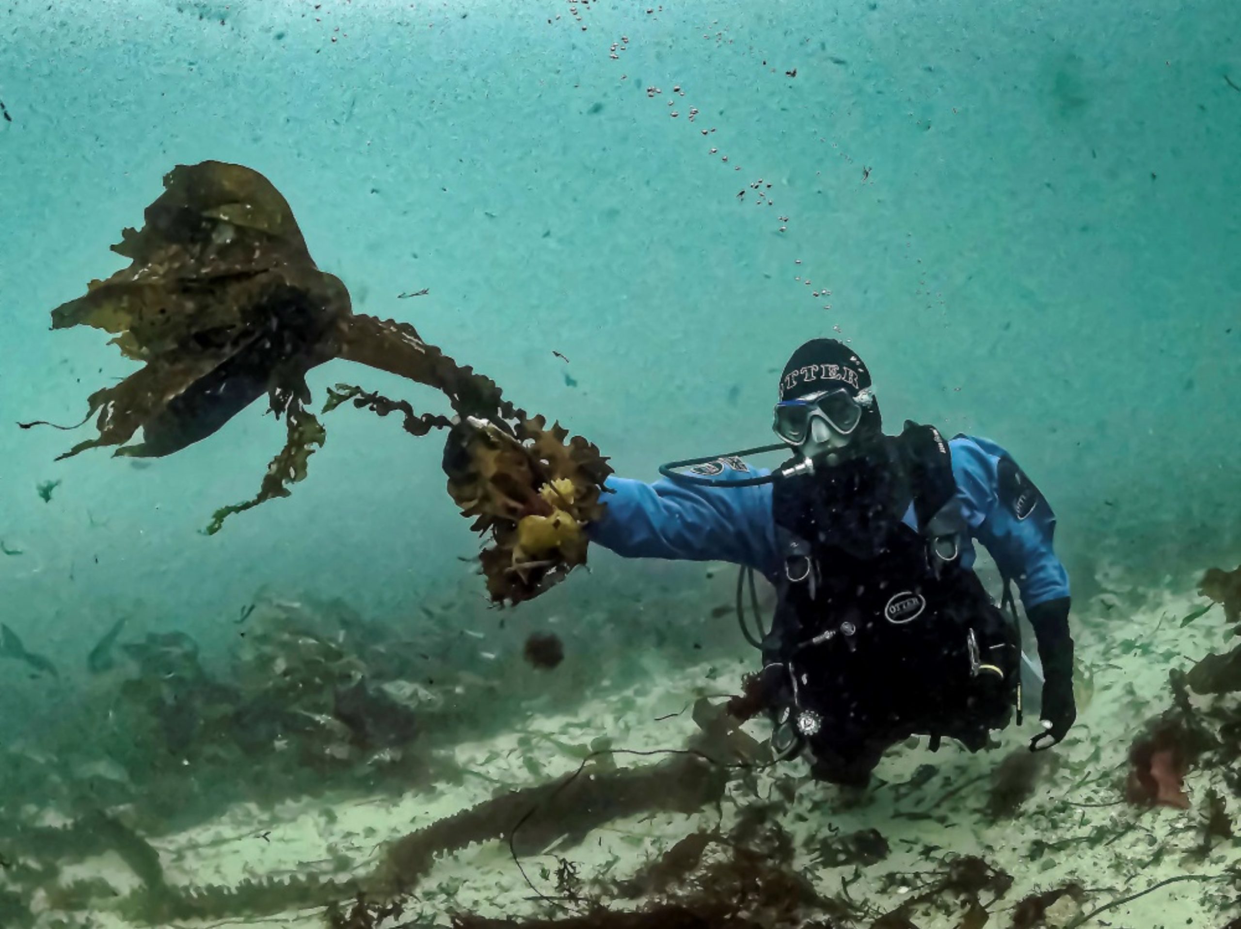
The first task was to remove the build-up of detached kelp stalks. These are often referred to locally as ‘skaffs’ or ‘kelp bombs’. They consist of a loose kelp frond, usually attached to a medium sized rock. These appear to drift onto the site from the west, carried by the flood tide.
A kelp ‘skaff’ being held aloft by a diver on the Colossus dive trail
The station marker buoys were then removed and replaced with new marker buoys and ropes. These are fastened to the concrete sinkers on site by passing them through the stainless steel loops which have been cast into the concrete. Small numbered plastic tags have been included beneath the station markers – these have the number etched into the surface and it is hoped they may resist weed growth.
Two of the new dive trail station markers in place on the refurbished dive trail (stations 1 and 11).
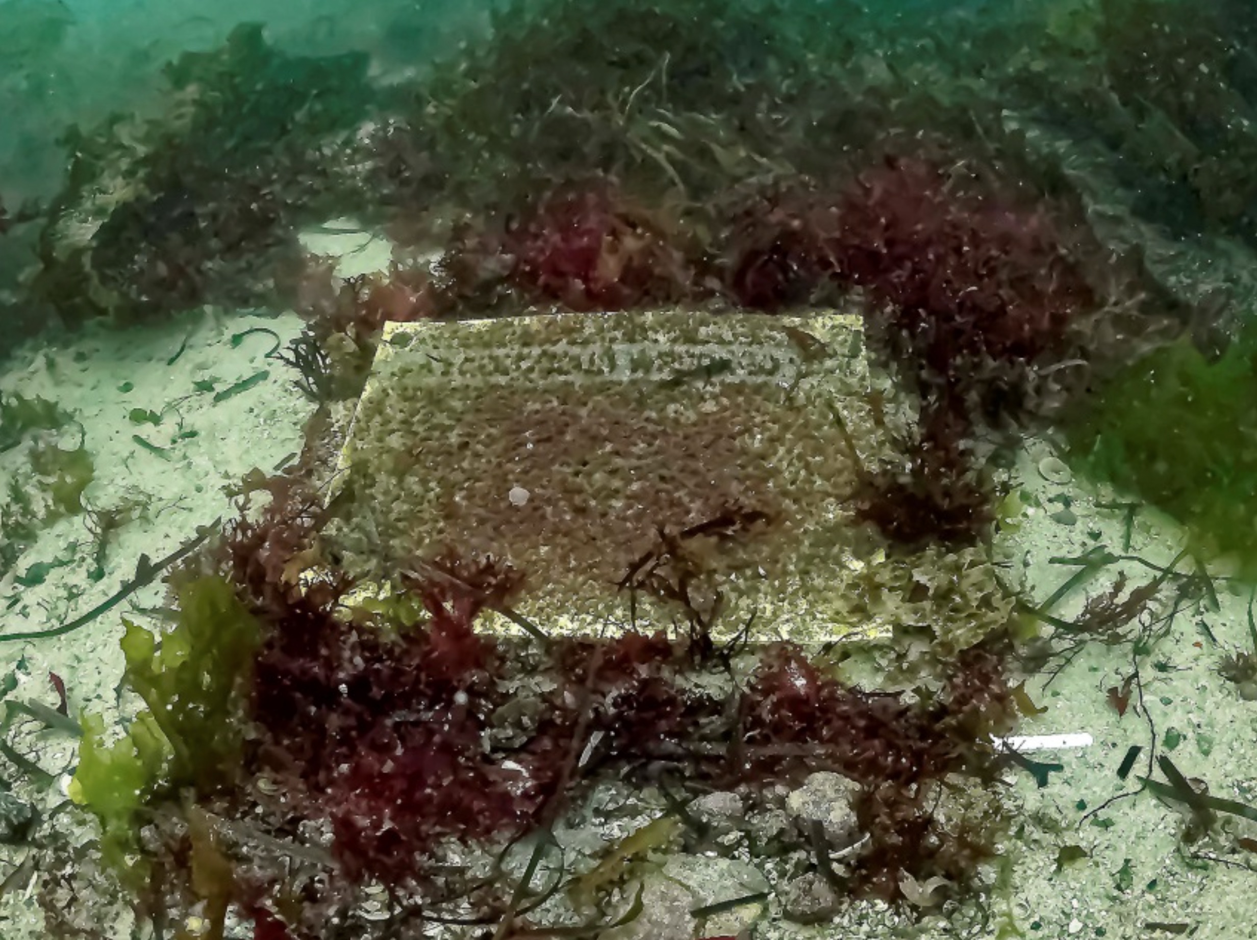
The seabed sign was cleared of the marine growth which was obscuring the sign; this was accomplished using a nylon scouring pad.
The seabed sign after cleaning – some of the marine growth has become embedded into the fabric of the sign. The sign will probably need replacing at the next refurbishment of the dive trail.
The lead-weighted bottom lines which guide divers around parts of the dive trail were checked, de-weeded and renewed where necessary, and additional seabed fastenings installed.
Dive slate
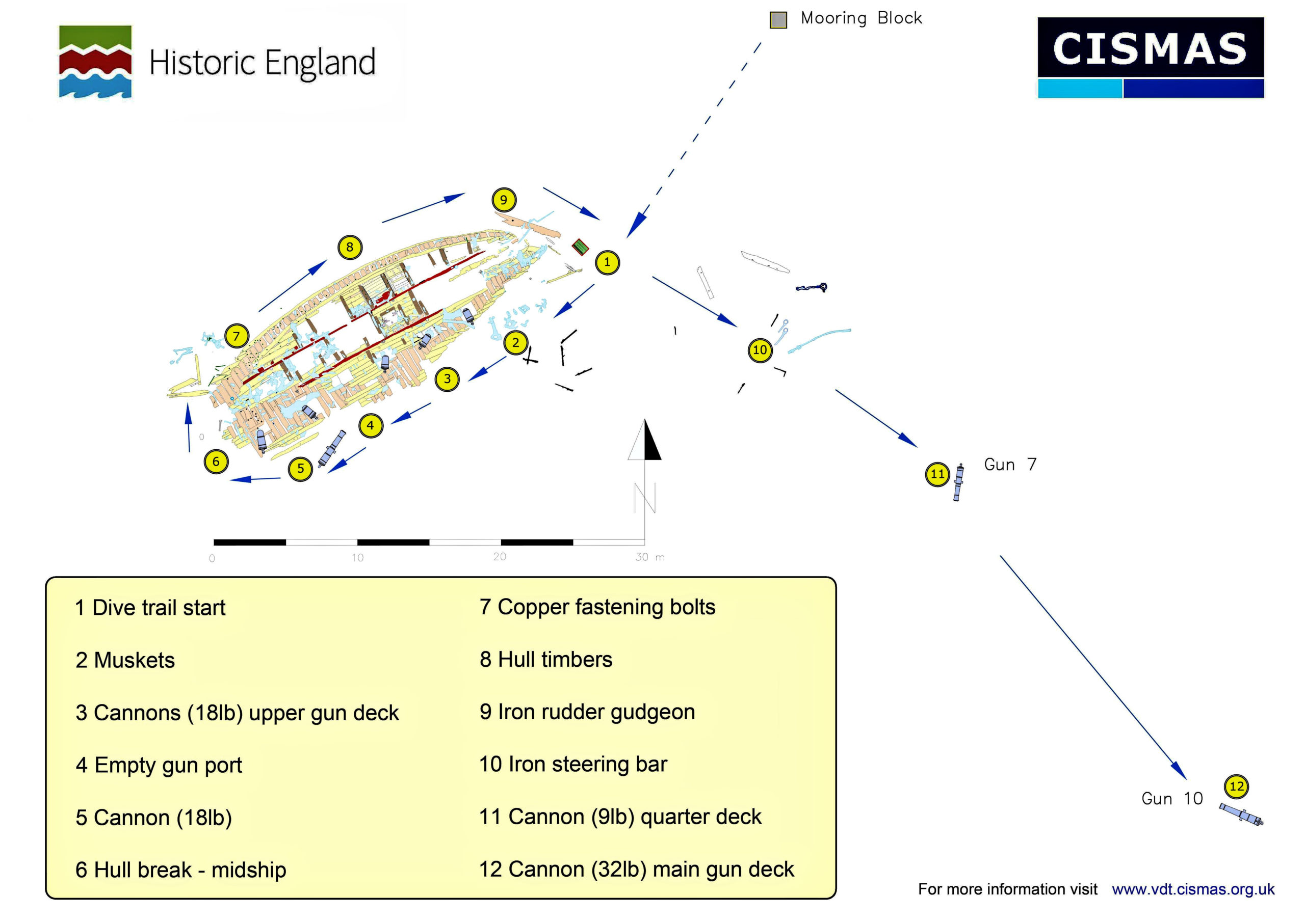
A new underwater information slate was designed. The previous underwater guide was a laminated multi-page guide; these have been in use for over five years and are starting to delaminate. The underwater dive guides are kept on board the dive charter boats in Scilly and loaned to the divers for the duration of their dive on Colossus. Having spoken to a number of these divers and to the diveboat skippers it was decided to replace the multi-page guides with a single A4 dive slate printed on both sides. The new slate is printed onto polycarbonate plastic and should be more durable than the previous, laminated guide booklet. Although the new slate has much less information it is easily portable for the site visit and contains a link to enable visitors to get further information from the online virtual dive trails for Scilly – this is designed to work on a smartphone and also contains information, videos and 3D models for the other protected wreck sites in Scilly.
The new HMS Colossus dive slate – front surfaceThe new HMS Colossus dive slate –back surface
Note the site plan has been simplified and much small detail removed to make the representation of the site clearer and easier to understand underwater. The dive slate is available to download as a PDF so that independent visiting divers can download and laminate their own information slate.
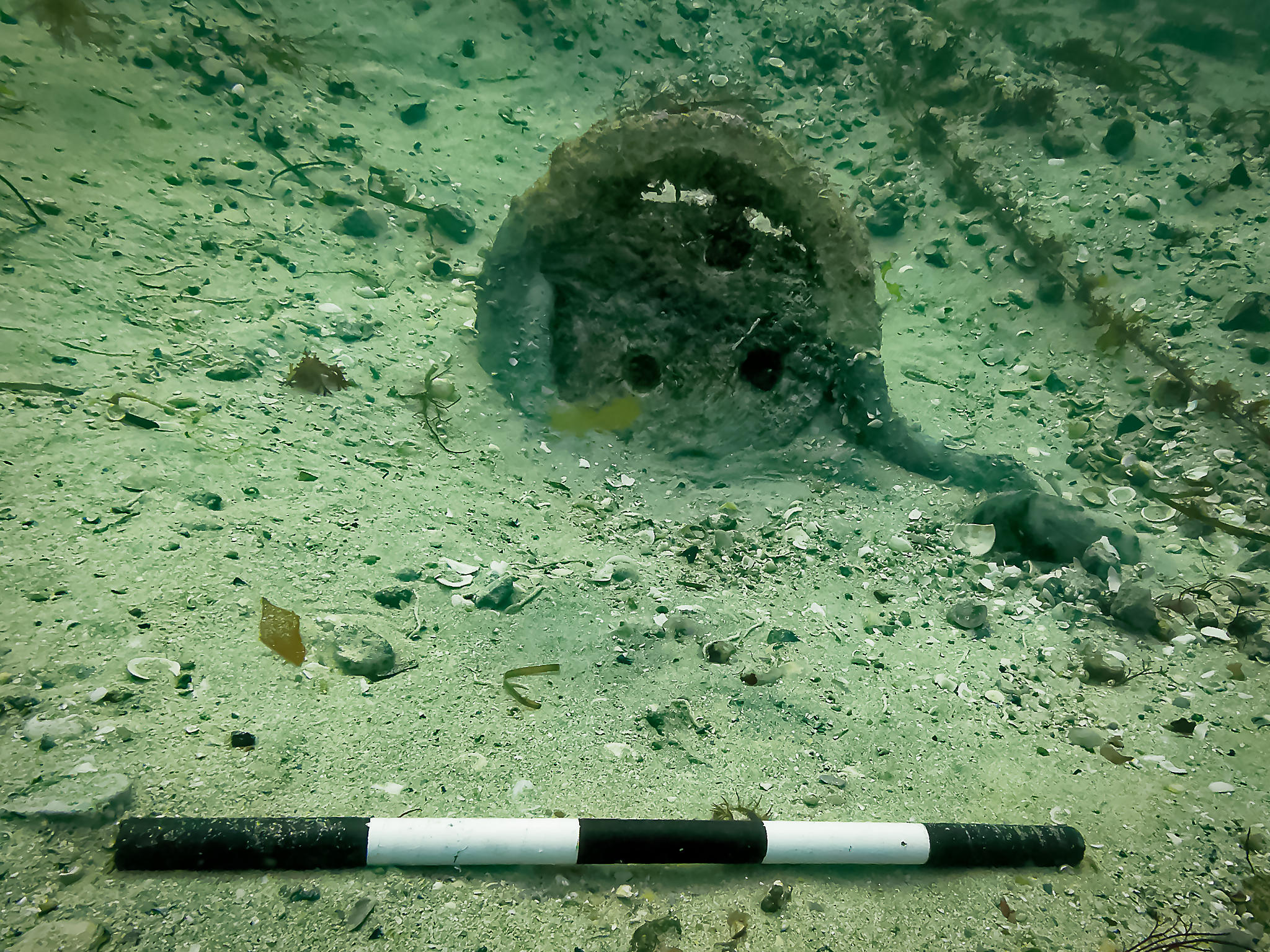
Several objects have been recently (2019) exposed on the seabed close to the Colossus dive trail. One of these is a timber lower deadeye complete with iron chains (C10.1). The chains are the iron straps used to fasten the lower deadeye to the outside of the hull of the ship. This deadeye is very similar to another (F1355) found in 2015 some 7m to the east .The diameter of the deadeye (440mm) is such that this would have been one of the main or foremast deadeyes – the mizzen deadeyes were smaller. It was partly buried within the seabed and lies on its edge rather than flat on the seabed. Although it lies right next to the dive trail around the site, this deadeye remained unrecognised until recently. A series of photographs was taken in 2019 to allow a 3D model of the deadeye to be made (Structure from Motion – SfM).
The deadeye and chains C10.1. The gap between the top of the deadeye and the iron chains is where the wood of the deadeye has decayed. Two of the three ‘eyes’ still contain rope.
Scale = 0.5m (taken with a very wide-angle lens which is why the scale in the foreground looks disproportionally large – one of the problems of underwater scales) – the central part of the deadeye is 0.44m in diameter
For the first time, divers and non-divers alike can experience and explore the protected historic wreck site HMS Colossus without getting wet! Historic England has commissioned a virtual wreck discovery trail for HMS Colossus – a 74 gun warship which sank off the Isles of Scilly in 1798.
The virtual trail mirrors the underwater dive trail that was created for HMS Colossus in 2009, where more than 2,300 licensed divers have explored the wreck by following a map of 12 numbered dive stations.
The interactive dive trail includes a 3D site plan, video of the underwater dive trail and plans and photographs of the wreck site. There are also facilities for visiting divers to leave comments, photographs and video of their visits on the site. The virtual trail has been designed to work on smartphones as well as on conventional computers.
Alison James, Maritime Archaeologist at Historic England said: “The Colossus virtual discovery trail has been designed to provide a better experience for visiting divers and enable them to provide feedback on their visit to the site. We hope they will share their photographs and video and that these can be incorporated into the new virtual trail.”
Alison James continued: “Protected wreck sites are as much part of our national heritage as castles and country houses but are not as widely accessible! This new virtual dive trail opens up our underwater heritage to many more people and encourages greater understanding and recognition of England’s historic wrecks.”
The virtual discovery trail was produced for Historic England by independent archaeologists Kevin Camidge and Tom Goskar. Project Manager Kevin Camidge said: “The new virtual dive trail brings the site alive and includes a ‘diver’s eye view’ video of the whole dive trail, which gives the non-diver a pretty good idea of what it’s like to dive the site.”