In April 2017 a multibeam sonar survey of the designated historic wrecks in Scilly was undertaken on behalf of Historic England. The wrecks surveyed were Association, Colossus, Tearing Ledge, Bartholomew Ledges and The Wheel Wreck.
Multibeam sonar is a method for mapping the seabed. An array of sound pulses sent from the survey vessel measure the depth of the seabed. This data is linked to an accurate GPS position to produce a quick and accurate 3D map of the seabed and any wreckage lying on it.
This data was used to produce the model of the seabed which you see here.
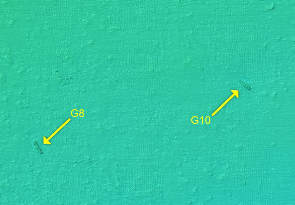
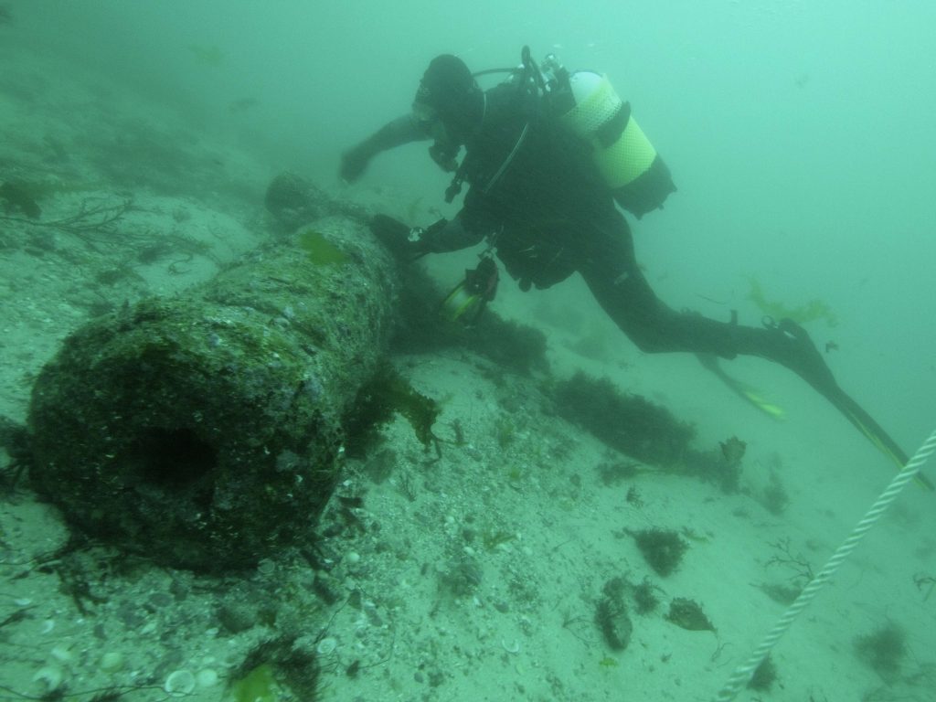
A small section from the multibeam sonar survey of HMS Colossus showing two of the 32 pound cannons lying on the seabed to the south of the main section of wreckage (shown arrowed as Gun 8 and Gun 10). By way of comparison a photograph of gun 10 on the seabed is shown below.
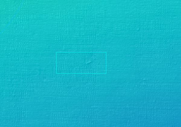
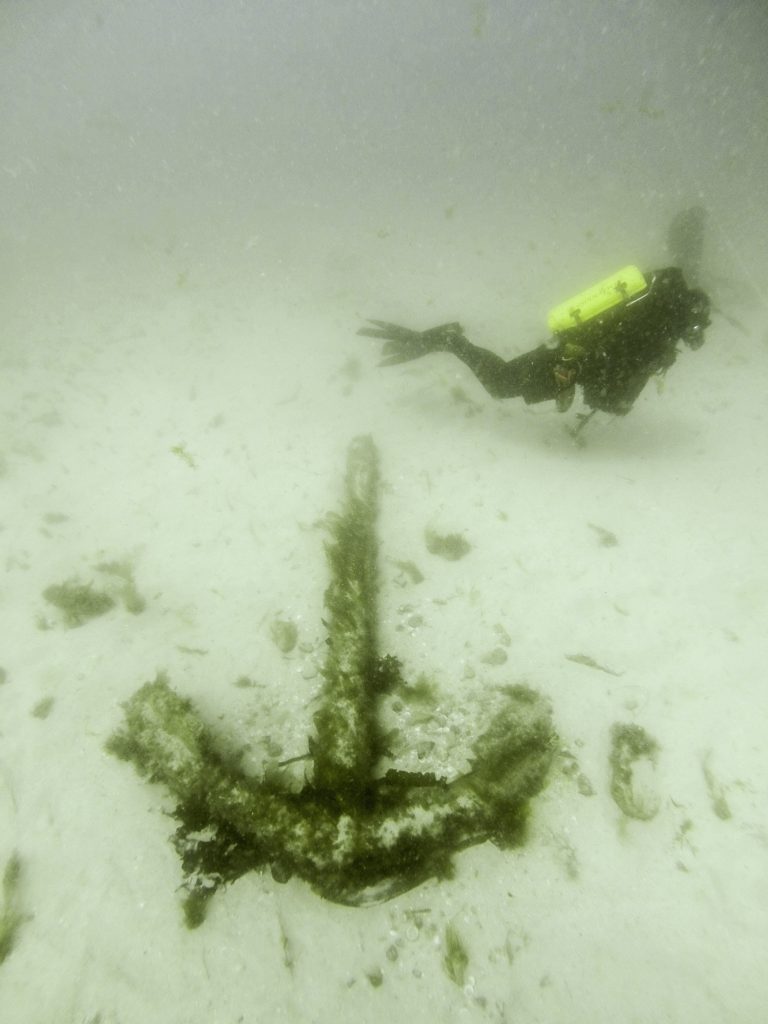
This detail from the HMS Colossus multibeam sonar survey shows a small anomaly (outlined with a blue rectangle) on the seabed. When divers investigated it they found it was an iron anchor.