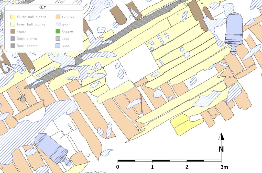
The row of upper gun-deck ports was one of the first things recorded on the wreck in late 2001 and early 2002. At that time, we were faced with over 350 square metres of seabed to draw and next to no resources to achieve this (not even a planning frame). The early drawing was undertaken at a scale of 1:20 – which limits the amount of detail that can be shown, but enables 4-5 square metres to be drawn per hour. In later years we drew the site plan at a scale of 1:10, which allows much more detail to be recorded – but it takes about four times longer to cover the same area.
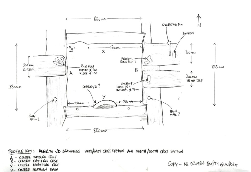
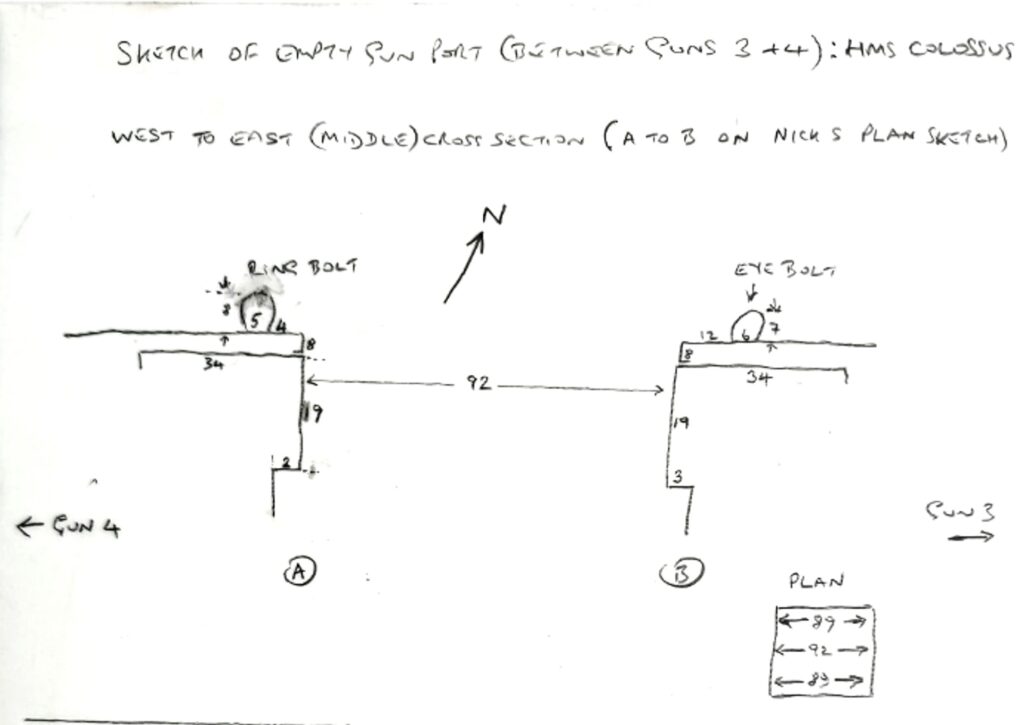
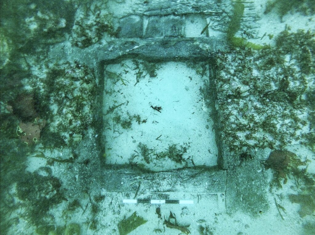
We had been aware for some time that the empty upper gun-deck port (dive station 4) no longer looked as it had when drawn back in 2001. Therefore, one of our tasks for 2024 was to produce a measured sketch and profile of it, to determine what had changed in the intervening 20 years. It was also a good opportunity for team members to brush up on their recording skills – which had been sadly underemployed of late.


Comparing the two drawings it is clear that a great deal of timber shown on the 2001 plan no longer exists. Much of the inner hull planking has now gone – exposing the gun port lintel, sill beams and many more of the hull frame timbers. The inner hull planking was constructed of substantial strakes of around 12 inches wide by 3 inches thick, which were in near-perfect condition when first seen in 2001. it has only taken a little over twenty years for these to largely disappear from around the gunport. Similarly, the deck planking of the upper gun deck shown in the original drawing is, sadly, no longer with us.
It is now also possible to see damage to the gun-port lintel (the timber along the south side of the port), in the form of a missing central curved section. This was probably caused by the upper part of the gun muzzle striking the lintel on recoil (which could be particularly violent when the gun was hot). To reduce this type of damage, naval guns have flared muzzles while garrison guns often have a ring at the muzzle. There is a similar piece missing from one end of the gun port sill.[1]
The sediment level recording indicates that the seabed levels around the wreck have continued to fall – inevitably exposing more timber. But it is now clear that significant parts of the hull timbers have decayed and no longer exist. Unfortunately, our site plan is now a record of what existed when it was drawn, not what is there today.

[1] The horizontal ‘frame’ timber above the gun-port was called the lintel, while that at the bottom was called the sill